 AEC Terrain v.2.0
Advertisement
Description
Introducing you AEC Terrain interface which is designed to simplify terrain management and 3D-modeling. AEC Terrain creates Digital Elevation Model from multiple input point files on AutoCAD graphic editor. All purpose multi-level pads, road alignments, mining applications and airfields can be generated on the terrain on different layers with different slope parameters for CUT and FILL
The mechanism of AEC Terrain interface is very...
Read more
- Rate:
- Release Date:11/09/2013
- License:Shareware
- Category:Project Management
- Developer:AEC Logic Private Limited
- Trial length:1 Day Trial
- Downloads:413
- Size:16.33 Mb
- Price: $750.00
To free download a trial version of AEC Terrain, click here
To buy software AEC Terrain, click here
To visit developer homepage of AEC Terrain, click here
Advertisement
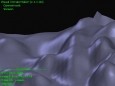
Screen Shot
Click on a thumbnail for the larger image.

System Requirements
AEC Terrain requires WinXP, Win7 x32, Win7 x64, Win2000, WinServer, WinVista, WinVista x64.
AEC Terrain v.2.0 Copyright
Shareware Junction periodically updates pricing and software information of AEC Terrain v.2.0 full version from the publisher using pad file and submit from users. Software piracy is theft, Using crack, password, serial numbers, registration codes, key generators, cd key, hacks is illegal and prevent future development of AEC Terrain v.2.0 Edition. Download links are directly from our publisher sites. Links AEC Terrain v.2.0 from Bittorrent, mediafire.com, uploadfiles.com, hotfiles.com rapidshare.com, megaupload.com, netload.in, storage.to, depositfiles.com and other files hosting are not allowed. The download file is obtained directly from the publisher, not from any Peer to Peer file sharing applications such as Shareaza, Limewire, Kazaa, Imesh, eDonkey, eMule, Ares, BearShare, Overnet, Morpheus, BitTorrent Azureus and WinMX.
Review This Software
More AEC Terrain Software
Advertisement

Terrain Tool for AutoCAD v.1.2
Terrain Tool offers a strong way of designing, analyzing and presenting terrains in AutoCAD. It was developed with the needs of architects and landscape architects in mind.
Visual Terrain Maker v.1.4.0.0
Visual Terrain Maker is a program allows to visually create 3D landscapes (terrains), convenient and easy in use. Works in XP/NT/2k. Saves in DirectX (.X) format and .glo. The program is not critical to the video adapters and drivers.
Terrain Tools v.5.077
Terrain Tools - Create maps quickly and easily!
Nem's Mega 3D Terrain Generator v.2 3
Nem's Mega 3D Terrain Generator is a relatively new terrain generator that takes a step in a completely different direction.
AEC Slope 2009 v.1.0
Earth embankments are widely used for roads, railways, river training works, canal embankments, dams, etc. AEC Slope 2009 is used for analyzing stability of slopes for the above structures and reporting safety factors.
Terrain Analysis Package (TAP) v.4.0.1081
SoftWright is the developer of the Terrain Analysis Package - TAPtm- for Windows XP PC-based software to perform evaluation of existing or proposed radio transmitter sites; radio coverage predictions, intermodulation studies and radio transmitter sit
Terrain v.5.077
Terrain: Explore the vast, engrossing storyline.
Terrain for AutoCAD v.1.0
Terrain for AutoCAD is a terrain modeling plug-in for AutoCAD. This plug-in gives AutoCAD the ability to create a terrain mesh from a set of unordered points. The terrain mesh is created as a Delaunay Triangulation,
Terrain for Rhino 3.0 v.1.0
Terrain for Rhino is a terrain modeling plug-in for Rhinoceros (commonly known as Rhino). This plug-in gives Rhino the ability to create a terrain mesh from a set of unordered points. The terrain mesh is created as a Delaunay Triangulation,
Terrain Profiler v.1.0
Terrain Profiler shows the terrain profile layer in action with its various controls. It allows you to view a realtime section profile graph for any place on the planet, at any scale - continent, country or mountain range, just by moving the mouse.
Other products of this developer AEC Logic Private Limited

AEC 3D Culverts-Box v.2.0
Program models in 3D of standard or of box type ...roads, canals, dams, and railway banks projects.

AEC 3D Culverts-Pipes v.2.0
AEC 3D Culverts-Pipes is a solution helping civi...drainage structures for highway, canal projects.

AEC 3D Culverts-Slab v.2.0
Models in 3D standard or custom culverts of slab..., canals, dams, railway banks & runways projects

AEC 3D ReBar v.1.0
3D modeling application, bar bending scheduler d... diagrams, draws reference linesfrom 2D AutoCAD.

AEC Budget v.4.0
AEC Budget application for budgeting, Cost Estim...are for accurate management of critical figures.

AEC Buildings v.2.0
2D-to-3D AutoCAD drawings, 3D Converter, Buildin... 3D, Building quantity take off, quantity manage

AEC CutFill v.1.6
Calculates Earthwork Cut fill volume areas earth...avations, parking, retaining walls, mining, land

AEC Roads v.1.0
Road Highway designing Horizontal and vertical a...d Model from Field-to-Finish for Infrastructure.

AEC Slope v.1.6
Analyzestability of slopes for roads, railways, ...rawing, Swedish Slip Circle,withGraphical Output